
Interactive Wayfinding for Signage Networks
One platform, every venue you manage. Maps your operators change in minutes, routes your visitors can trust.
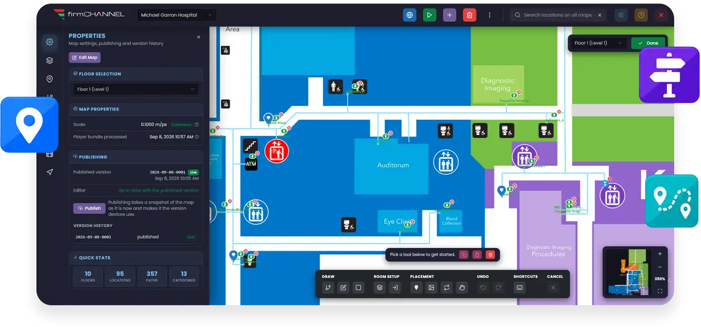
Run interactive wayfinding on the same firmChannel platform that already runs your screens. Import a venue's floor plans, publish a map, and every kiosk, signage player, and visitor's phone on that site gets the same directions: across floors, step free when needed, in sixteen languages, and still working when the network is not. Manage one building or a portfolio of them from a single place.
Wayfinding That Scales the Way Your Network Does
Most wayfinding products are built for one building. firmChannel Wayfinding is built for the people who run many.
Unlimited maps
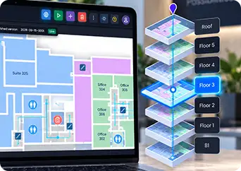
One map per building, campus, venue, or client, with no ceiling on how many you run. Each map has unlimited floors, including below grade levels, with its own short codes, display names, and ordering.
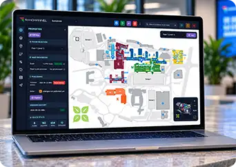
Every client in their own dedicated portal
Maps are fully isolated, each with its own interface, layout, and assets. Deactivating a map instantly shuts down its player, mobile page, and QR endpoint.
Your brand, or your client's
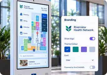
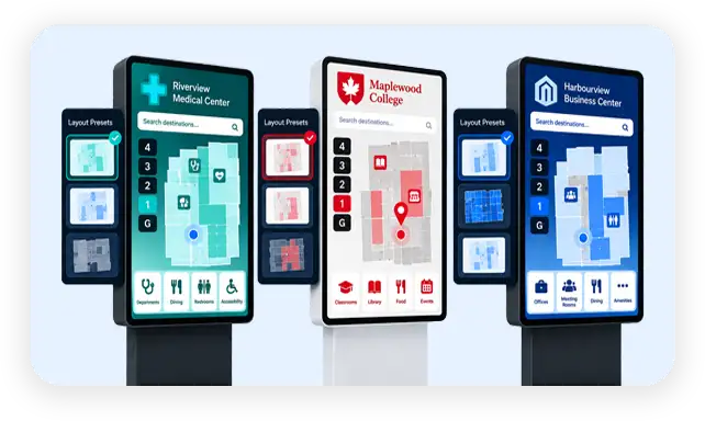
Every visitor facing element is customizable per map, including colors, fonts, sidebars, legends, and the Powered by branding.
Publish once, reach the whole venue
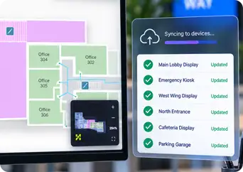
A published map rebuilds its offline package and every device on that site picks it up automatically. Devices sync by delta, so only what changed crosses the wire.
Control who touches what
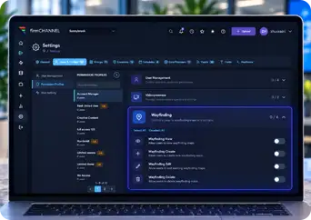
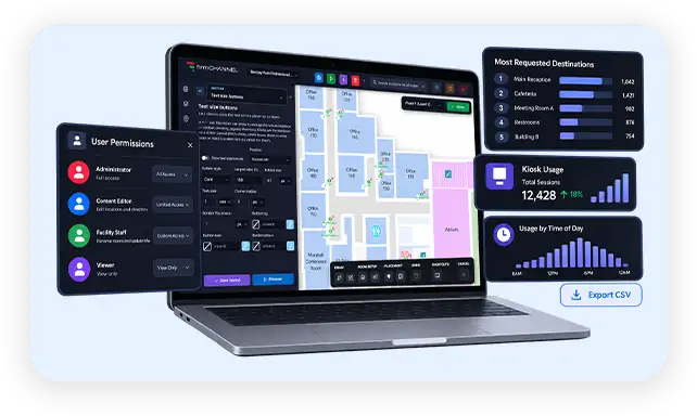
Role based permissions use existing profiles for basic actions, while higher risk tasks such as data imports, exports, and rebuilds are restricted to staff.
What Visitors Experience
Six stages, from the moment someone walks up to a kiosk to the moment they arrive.
Find it
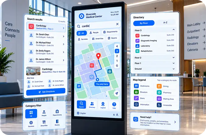
Search filters as the visitor types, across every room, person, service, and amenity. One destination can answer to many names: four physicians sharing a suite each get their own entry, and the destination card lists the others under Also here. Extra keywords mean a search for coffee finds the cafe, and a search for radiology finds Diagnostic Imaging even when nobody named it that.
A category filter sits in the search field. The sidebar directory can be grouped by floor or shown as one alphabetical list, color coded by category with icons and optional zone, room, and floor columns. Legend rows can be live: tap Washrooms and the map routes to the nearest one from where the visitor stands. Rooms are tappable directly on the map, and an optional help panel explains how it all works, in the visitor's language, reworded per map if you wish.
Follow the line
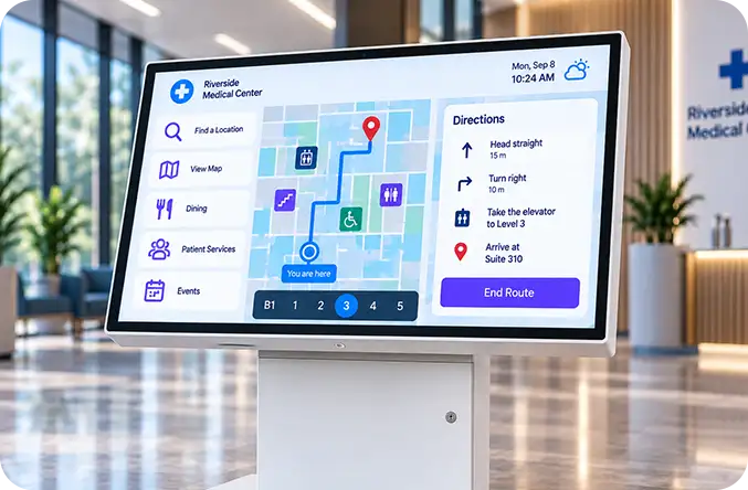
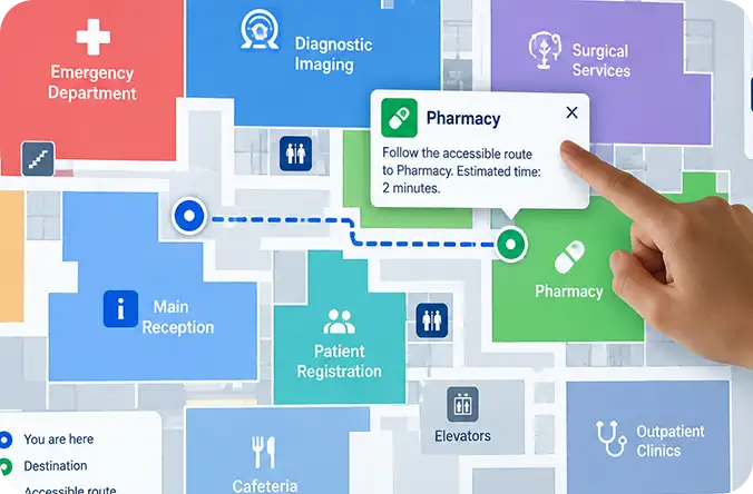
The route animates from You are here to the destination at a walking pace you set, so the eye follows the line rather than arriving at a finished squiggle. Elevators, stairs, escalators, and ramps are handled as connections between floors: the map changes floors as the route does, with a banner at each handover and a floor strip across the bottom showing every level the trip touches. Routes that cross floors can advance on a timer with a pause to read the instruction, or wait for the visitor to press Continue. A replay button redraws the leg or the whole route.
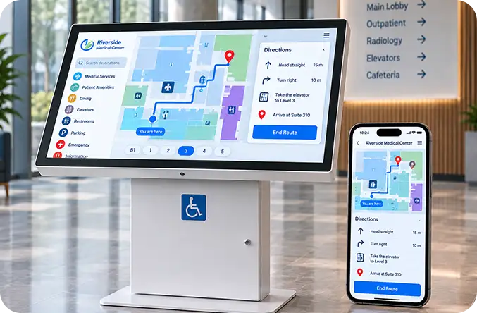
A turn by turn drawer gives real instructions, such as bear right, take the elevator to Level 3, arrive at Suite 210, with real distances in metric or imperial once the map is calibrated. Every kiosk records the direction it physically faces, so turn left means left as the visitor is standing, not left on a plan drawn with north at the top. The destination sits in a callout with a leader line, its floor, category, description, and a full width Navigate button.
Take it along
Scanning the kiosk QR code bridges the public display to the visitor's own device, launching the interactive map inside their mobile browser with no app download, installation, or account setup. Because the QR code carries both the kiosk identifier and the target destination, the mobile page loads with the route already calculated and drawn.
Visitors get the same features as the main display, including live search, category filters, floor switching, and accessible routing, so they can follow clear, portable turn by turn directions as they walk the building.
In their language
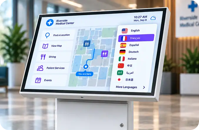
Sixteen languages of turn by turn directions are built in: English, French, Spanish, German, Italian, Portuguese, Dutch, Russian, Simplified and Traditional Chinese, Japanese, Korean, Arabic, Hindi, Vietnamese, and Tagalog. Room names, descriptions, categories, and floor names translate, not only the buttons.
The visitor facing switcher changes everything at once, including the on screen keyboard layout, and Arabic renders right to left. Each map has its own language set, so a bilingual hospital and a five language airport are not forced into the same list, and a kiosk can be published in one fixed language with the switcher hidden.
Accessible by design
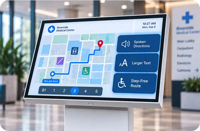
firmChannel Wayfinding conforms to WCAG 2.2 Level AA. A kiosk is a locked device: visitors cannot attach their own assistive technology or reach the operating system, so the application has to supply the equivalent itself. Three controls belong to the visitor at the kiosk, with no staff assistance:
- Spoken turn by turn directions through the kiosk speakers.
- A text size toggle the visitor operates with one tap.
- Step free routing that avoids stairs and escalators and sends visitors to elevators and ramps, using only the transitions the venue has marked accessible.
Underneath, the routing engine carries four profiles, standard, wheelchair, no stairs, and stairs only. Every path and transition carries its own accessibility flag so your data decides rather than a guess, and accessible routes are precomputed into the offline package so the option works with the network down. Text sizes, contrast, panel colors, and label sizes are configurable per location as well.
Kiosk manners
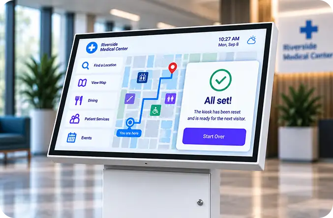
After a period of inactivity, the kiosk resets itself to a clean slate, clearing searches, dropping active filters, removing routes, closing the keyboard, restoring the sidebar, reframing the camera, and returning to the default opening floor. For visitors who want to reset manually, an optional Start Over button appears only after someone has used the interface.
Each map can be configured for its preferred opening view, whether that shows the entire floor or focuses tightly on the kiosk's location, while every unit recognizes its own floor and anchors its own You are here pin.
What Your Operators Work With
Everything below happens in one browser page: a map picker, a tabbed side panel, and a full height interactive canvas. No design software, no developer, no change request to a map vendor.
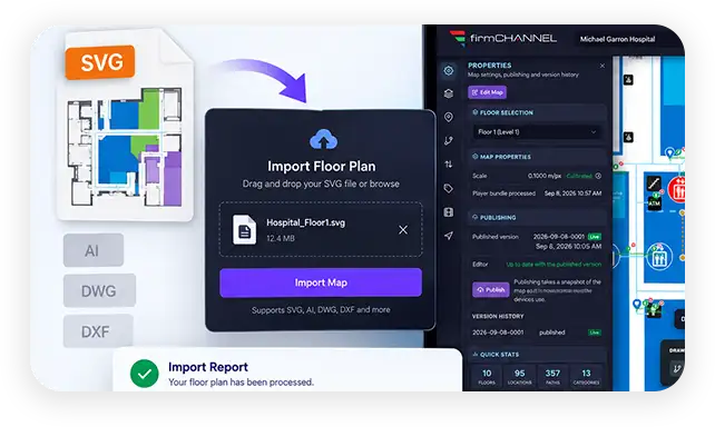
From floor plan to routable map
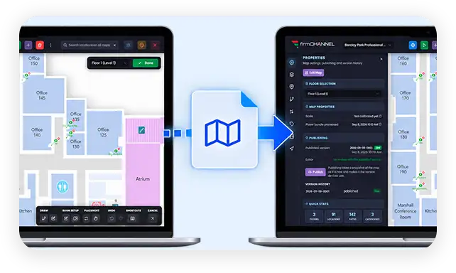
Import existing SVG floor plans and automatically turn rooms, corridors, labels, and kiosk markers into a routable map. firmChannel also flags anything ambiguous or skipped in a clear import report.
Draw what the artwork lacks
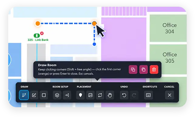
On canvas tools give you grid snap, undo and redo, and shortcuts to draw corridors, trace rooms, define plazas, place kiosks, link elevators across floors, and calibrate scale, backed by auto connect and orphan reporting.
Content without artwork changes
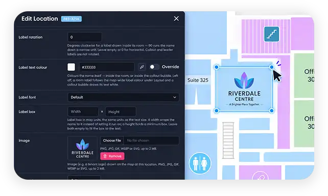
Location records carry unlimited aliases and logos. Managed labels override SVG text, alongside custom room colors, icon categories, previewed spreadsheet imports, and translations drafted by AI.
The routing network under your control
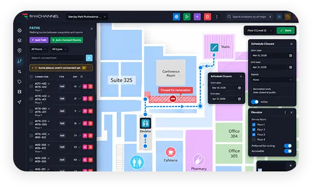
Eight path types support one way routing and scheduled closures for renovations or after hours. Elevators that serve several levels behave as single objects, with transition preferences and paths you can edit in bulk.
Test, then publish
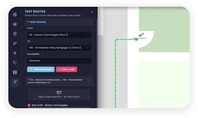
Test routes preview any path while you are still editing, and a five point audit checks routing gaps, missing translations, icons, and kiosks. Maps use a working copy, so live screens keep showing the last published version until you publish, and every publish is versioned and can be rolled back.
Branding and wording
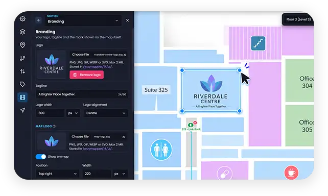
Three layout presets and the styling around them govern logos, sidebars, directories, search, keyboards, legends, controls, route line properties, theme colors, fonts, and full interface text overrides per map and language.
Where It Runs, and What Happens When the Network Drops
Where it runs
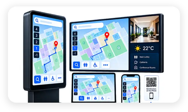
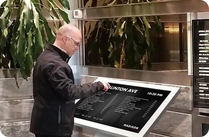
Wayfinding runs across touch kiosks, digital signage players, signage layouts, phones, and standard browsers. Live maps can sit alongside video, playlists, and data feeds, while QR handoff lets visitors continue directions on their phone.
When the network drops
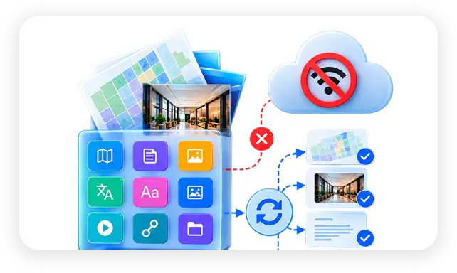
Each map stores a complete offline bundle with floor plans, directory content, translations, and routes, so directions keep working without a network. Updates sync automatically while preserving each kiosk's identity.
Deploying Wayfinding for Your Clients
If you build and run signage for other organizations, the rollout matters as much as the feature set. Three things are designed for that.
Author on your server, deliver to theirs
A finished map exports as a single portable bundle, with floor plans, locations, aliases, categories, icons, images, logos, schedules, paths, transitions, and every translation inside it, and imports on the client's production site as a brand new map. Client sites are never used as a workbench.
Make each venue look like itself
Layout presets get a new venue to a credible first draft in minutes, and layouts and wording set per map mean two clients on the same platform never look or sound alike.
Hand over the right amount of control
Role based permissions let client staff update rooms and directories while advanced operations stay with your team. Wayfinding analytics track top destinations, kiosk usage, and demand trends with CSV export. Because Wayfinding runs on firmChannel, the same screens can also display signage content and CAP 2.0 emergency messaging.
Wayfinding Across the Networks You Serve
Healthcare systems
Health networks with several sites can run a single platform across every location while keeping a dedicated map for each hospital. Because step free routing is the default, the system meets the accessibility needs of patients and visitors without extra work.
Spoken directions and a text size toggle support the closed functionality accessibility requirements that HHS Section 504 sets for public wayfinding kiosks.
Government and civic
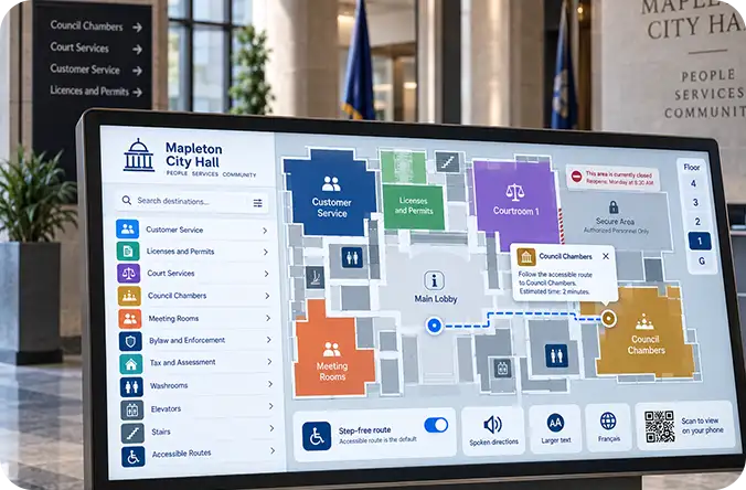
Public institutions such as courthouses, service centres, and municipal buildings face strict accessibility and compliance obligations, including AODA in Ontario and the DOJ Title II rule in the United States.
Scheduled closures handle secure zones and after hours wings automatically, with no paper notices taped to doors. Wording set per map lets public bodies match the terminology their own teams and standards use.
Higher education
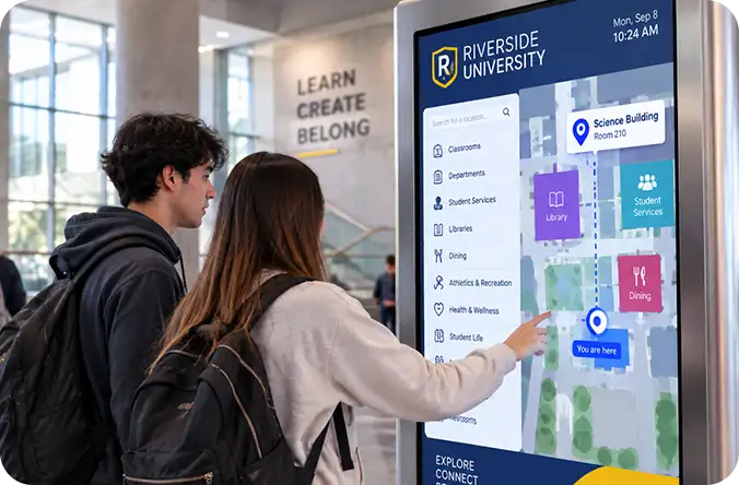
Campuses with dozens of buildings can manage each facility as its own map while controlling everything from a single platform.
Administrators can redraw rooms and reassign departments between terms in house, with no design agency involved. Analytics show which buildings' kiosks are earning their place and where visitors actually go.
Retail and mixed use
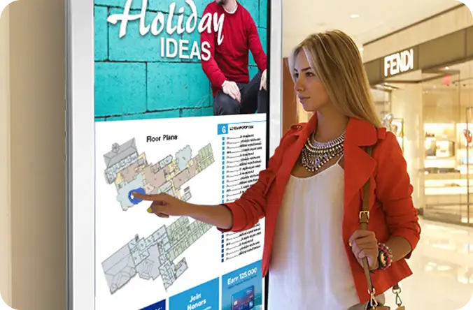
Shopping centres and mixed use developments can keep tenant branding accurate by swapping a retailer's logo the day a unit changes hands.
Operators can schedule closures for store fit outs so visitors stay informed with no manual signage updates, while leasing teams get destination analytics that evidence foot traffic to any specific unit.
Transit and airports
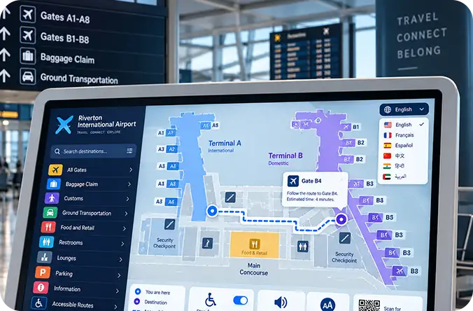
International passenger mixes are covered by sixteen languages, right to left layouts, and a visitor facing language switcher, so travelers navigate busy terminals in the language they prefer.
Offline data packages keep routing and directory services running through network disruptions, which matters for high traffic transport facilities that operate around the clock.
Corporate and property portfolios
Property managers can oversee large portfolios by running a dedicated map for each tower, styled with either the portfolio master brand or the building's own identity. Floor moves and renovations can be scheduled in advance so routes adjust themselves.
Role based access lets building staff and administrative teams keep the directory current without risking accidental changes to the routing underneath.
Every capability, in one place
The complete list, for anyone building a specification or comparing platforms.
Navigate with ease using a touch optimized interface, multi language keyboard, instant search, color coded directories, interactive legends, and animated routes. Multi floor and step free routing, turn by turn and spoken directions, adjustable text sizes, scheduled closures, QR mobile handoff, 16 language support, kiosk aware orientation, and WCAG 2.2 Level AA conformance help create an accessible visitor experience.
Import SVG floor plans with automatic routing network generation and clear import reporting. Build unlimited maps and floors using on canvas drawing tools for shapes, walkable areas, entrances, kiosks, and floor transitions. Automatic connections, map scale calibration, annotations, bulk CSV import, preview before apply, and translation assisted by AI make complex maps easier to build and maintain.
Manage room labels with flexible typography, images, colors, and category driven themes. Customize wayfinding pictograms, aliases, visibility, sidebars, labels, path types, accessibility, and direction in bulk or by individual room. Overrides per map and per language give you control over every interface string.
Create intelligent routes across floors with multiple accessibility profiles, path types, and one way or bidirectional travel. Configure accessibility by path or transition, connect transitions between floors, customize transition colors and icons, and set preferred transitions by destination or kiosk. Scheduled closures automatically reroute visitors, while route caching and precomputation keep navigation responsive.
Work from a separate editable copy while keeping the published version protected. Track version numbers and unpublished changes, roll back to earlier versions, review history that only moves forward, and test routes before publishing. A readiness audit with five checks helps verify changes before publishing, with previews across desktop, kiosk, mobile, and Harmony modes plus JSON export.
Customize the experience with layout presets, live preview, colors, fonts, logos, backgrounds, and panels. Configure the sidebar, search, keyboard, legend, floor picker, language switcher, QR panel, zoom, and reset controls. Customize legend rows and route styles, upload fonts, control the Powered by branding, and keep settings meant for editors hidden from visitors.
Keep wayfinding available with offline kiosk bundles, precomputed routes, delta sync, and automatic rebuilds. Support kiosk, signage player, embedded, Harmony class, mobile, and desktop experiences while maintaining persistent kiosk identities. Maps can be moved between servers, embedded into signage layouts, isolated by settings and assets, and managed through role based permissions, staff tools, and wayfinding analytics.
Learn more about Wayfinding
Can I run wayfinding for several clients from one firmChannel platform?
Yes. You run one map per building, campus, venue, or client, with no ceiling on how many. Each map is fully isolated with its own interface, layout, assets, and language set, so the venues you manage never bleed into each other.
Will my client see my brand, not yours?
Every visitor facing element is customizable per map, including colors, fonts, logos, sidebars, legends, controls, and the Powered by line. Two clients on the same platform never have to look or sound alike.
How do I move a map from my staging server to a client production site?
A finished map exports as a single portable bundle carrying floor plans, locations, aliases, categories, icons, images, logos, schedules, paths, transitions, and every translation. It imports on the client site as a brand new map, so client sites are never used as a workbench.
What happens when an operator edits a live map?
Editing happens on a working copy. Live screens keep showing the last published version until someone publishes, and publishing records a version you can roll back to. A readiness audit checks for routing gaps, missing translations, icons, and kiosks before you commit.
Does the wayfinding application meet accessibility standards?
It conforms to WCAG 2.2 Level AA. Because a kiosk is a locked device where visitors cannot attach their own assistive technology, the application supplies the equivalent itself: spoken turn by turn directions, a text size toggle, and step free routing, all operated by the visitor with no staff assistance.
How are temporary closures handled?
Schedule a closure on a path or transition with a start and end date, and routes avoid it for that window and return on their own afterwards. It suits renovations, secure zones, after hours wings, and store fit outs without anyone taping a notice to a door.
Can a map be embedded in a signage layout rather than run full screen?
Yes. A live map can sit inside a signage layout beside video, playlists, and data feeds, or run full screen on a touch kiosk. The same map also serves the mobile page a visitor reaches by scanning the kiosk QR code.
What hardware does it run on?
Touch kiosks, digital signage players, phones, and standard browsers. Each kiosk stores a complete offline bundle, so directions keep working when the network is down, and devices sync by delta so only what changed crosses the wire.
Bring Wayfinding Into Your Network
If you already run screens on firmChannel, wayfinding is one more thing those screens can do. If you are choosing a platform for a portfolio of venues, it is one place to manage all of them.